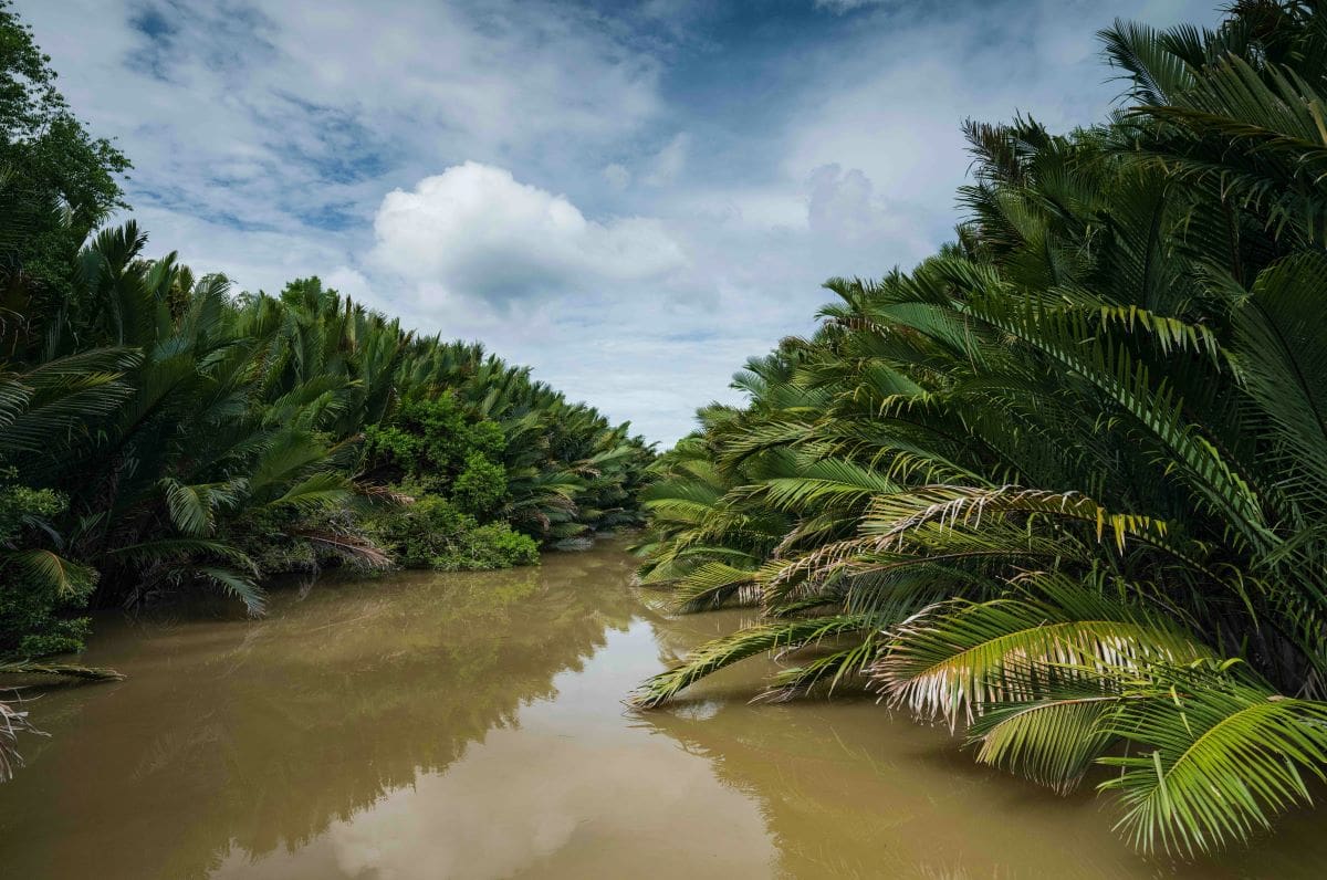
Sarawak, a historic region that is now a state of Malaysia, comprises the northwestern part of the island of Borneo. It is bounded by the sultanate of Brunei and Sabah (Malaysia) on the north and by Indonesian Borneo (Kalimantan) on the east and south. Sarawak has a low-lying and heavily indented coastline along the South China Sea. Much of its area is covered by primary rain forest. The alluvial, swampy coastal plain is backed by rolling country that is intersected by mountains and numerous navigable rivers.
Sarawak became the southern province of the sultanate of Brunei when the Majapahit empire of Java declined in the 15th century. James Brooke, an English adventurer and a former military officer of the East India Company, visited the territory in 1839 and aided the sultan in suppressing a revolt. As a reward for his services, Brooke was installed (1841) as raja of Sarawak over the sector from Tanjung Datu to the Batang (River) Samarahan. Sarawak was recognized as a separate state by the United States (1850) and Great Britain (1864) and, until 1905, was gradually enlarged through purchase and annexation. In 1941, the territory, devastated by war, was ceded to the British crown. Sarawak achieved self-government and joined Malaysia in 1963.
The Map of Sarawak
Landmarks
Explore Kuala Lumpur landmarks like Petronas Twin Towers, the KL Tower, the Thean Hou Temple, the National Mosque (Masjid Negara), and the Central Market, each offering a unique blend of cultural, architectural, and historical significance.
Neighborhoods
Explore the popular expat area of Bangsar, TTDI, Damansara Heights, Ampang, the vibrant Bukit Bintang, and the culturally rich Chinatown from Kuala Lumpur.
Food and Drinks
Kuala Lumpur offers a wide array of food and drinks and is known for its diverse food culture influenced by Malays, Chinese, Indians, and Eurasians, with must-try dishes such as Nasi Lemak, Satay, and Chili Pan Mee.
Shopping
Explore Kuala Lumpur shopping destinations from high-end malls like Pavilion KL and Suria KLCC, to local favorites like Central Market and Petaling Street, and even unique spots like Avenue K, The Curve, and Mid Valley Megamall.
Night Life
Kuala Lumpur’s nightlife popular spots such as Changkat Bukit Bintang, Jalan P Ramlee with its wide range of options for enjoying the nightlife, and KLCC (Kuala Lumpur City Centre), a multipurpose developing area that becomes one of the most popular nightlife areas by night.
Green Spaces
Kuala Lumpur is home to several green spaces, explore places like Taman Tugu, Kuala Lumpur Forest Eco Park, Perdana Botanical Gardens, and Permaisuri Lake Garden, all of which provide city dwellers and visitors alike with beautiful, tranquil spaces for recreation and relaxation.
Transportation
Kuala Lumpur boasts an efficient transportation network, from the MRT (Klang Valley Mass Rapid Transit), LRT (Light Rail Transit), Monorail, and KLIA Transit (KLIA Ekspres), to public buses, KTM Komuter, taxis, and e-hailing services, making it easy for both locals and tourists to navigate the city.
Accomodation
Kuala Lumpur offers a wide range of accommodations to suit every budget, from luxury hotels like the Hilton Kuala Lumpur and The Royale Chulan Kuala Lumpur, to more affordable options, all providing excellent service and facilities to ensure a comfortable stay.
Travel Tips
When traveling to Kuala Lumpur, it’s crucial to familiarize yourself with the city’s cultural diversity, use the efficient train system or Grab for commuting, prepare for hot weather, shop wisely, visit the gardens and night markets, and make sure to savor the national foods.